Nookfar's app icon

Your travels, drawn from your photos.

Nookfar turns the photos you already have into a map of where you've been and a journal of the trips that took you there.

In development · Not on the App Store yet · iPhone, iPad and Mac

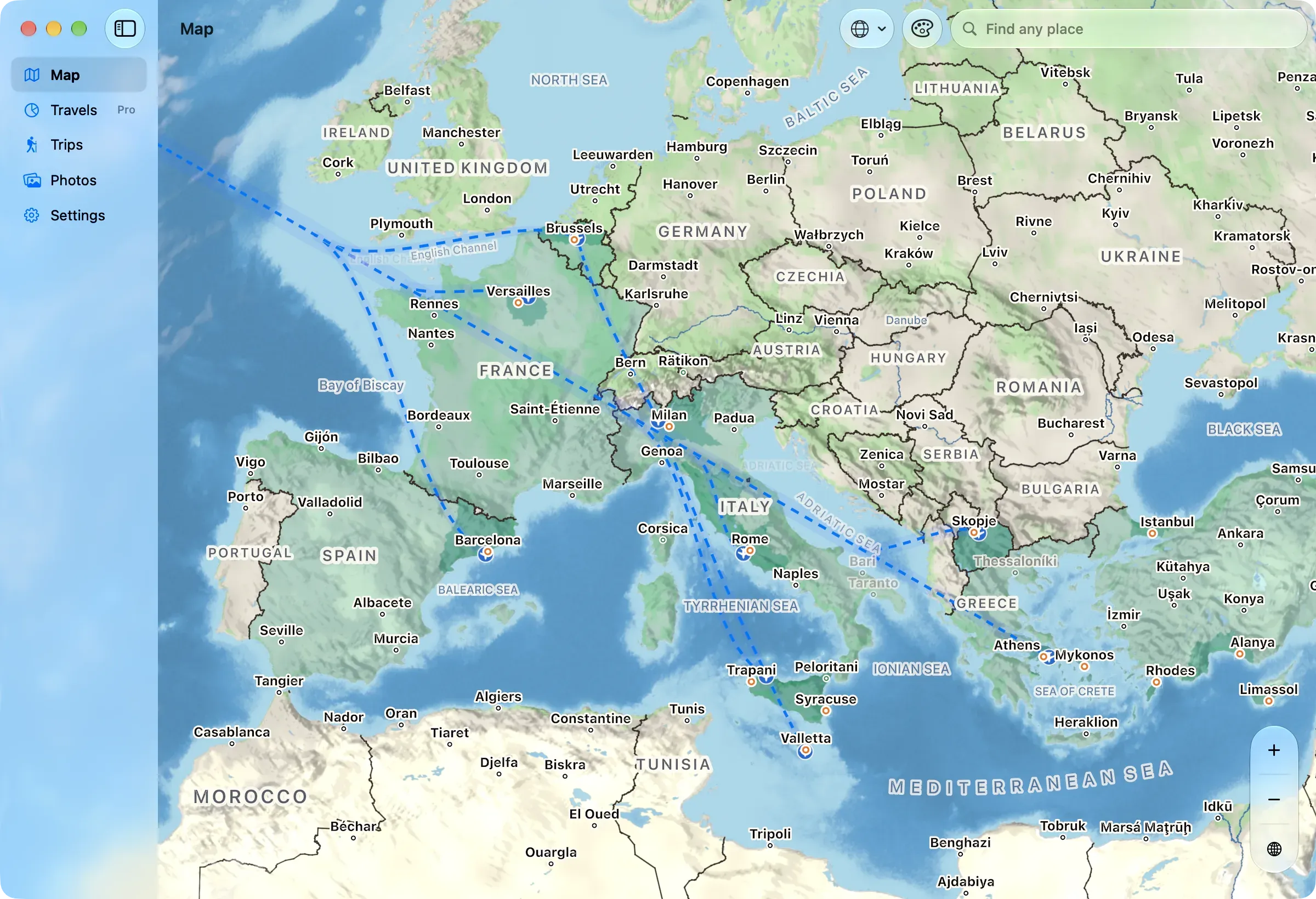
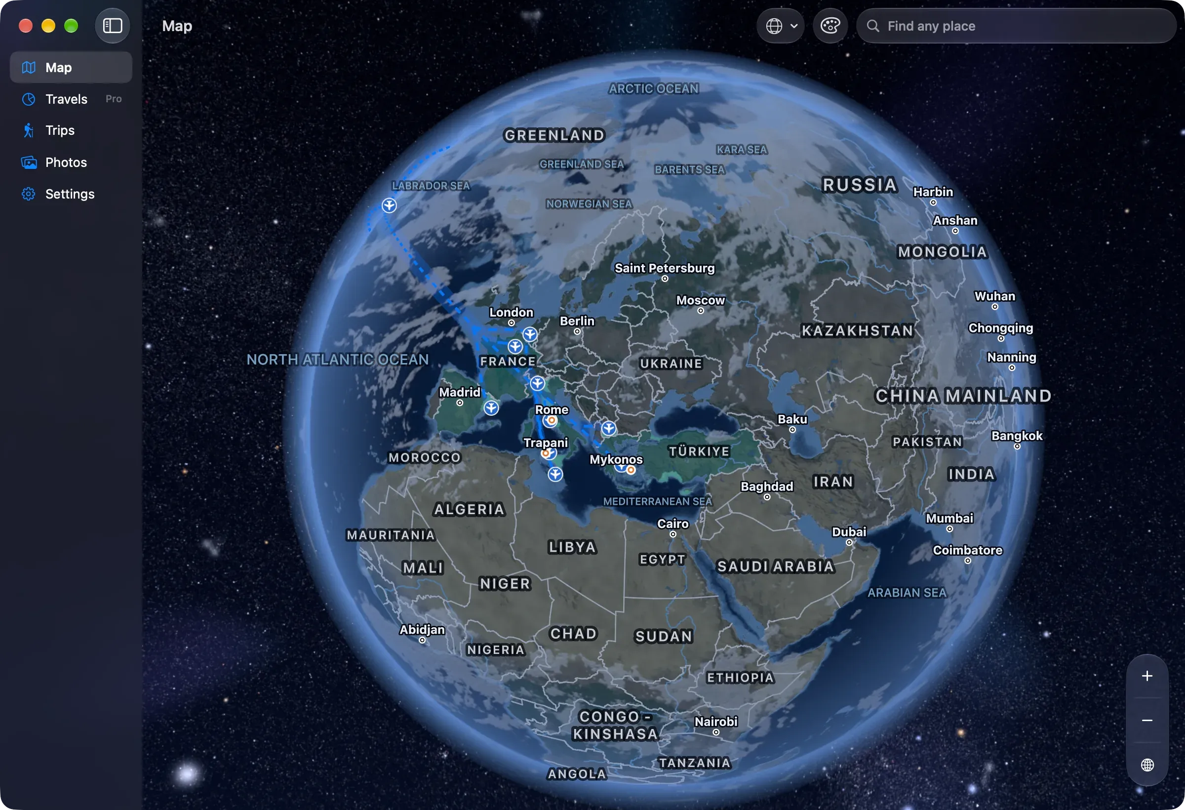
Nookfar on a Mac: the map of Europe and the Mediterranean, with the places visited shaded, and dashed flight routes arriving across the Atlantic at Brussels, Versailles, Barcelona and Milan, then on to Rome, Trapani, Valletta, Skopje, Athens and Mykonos.

The map

Everywhere you've been. Shaded in.

Countries and regions fill in as you add trips and the places you've lived, on a map drawn for every zoom.

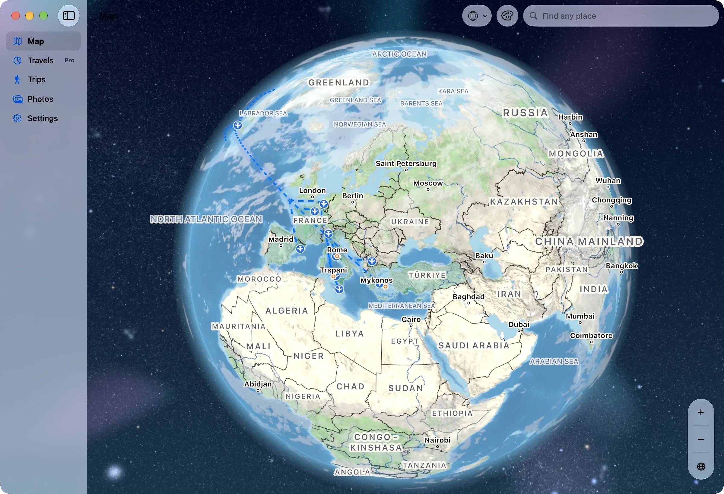
Nookfar on a Mac: the globe, from Greenland to India, with the visited countries shaded and dashed flight routes from across the Atlantic to France, Spain, Italy and Greece.
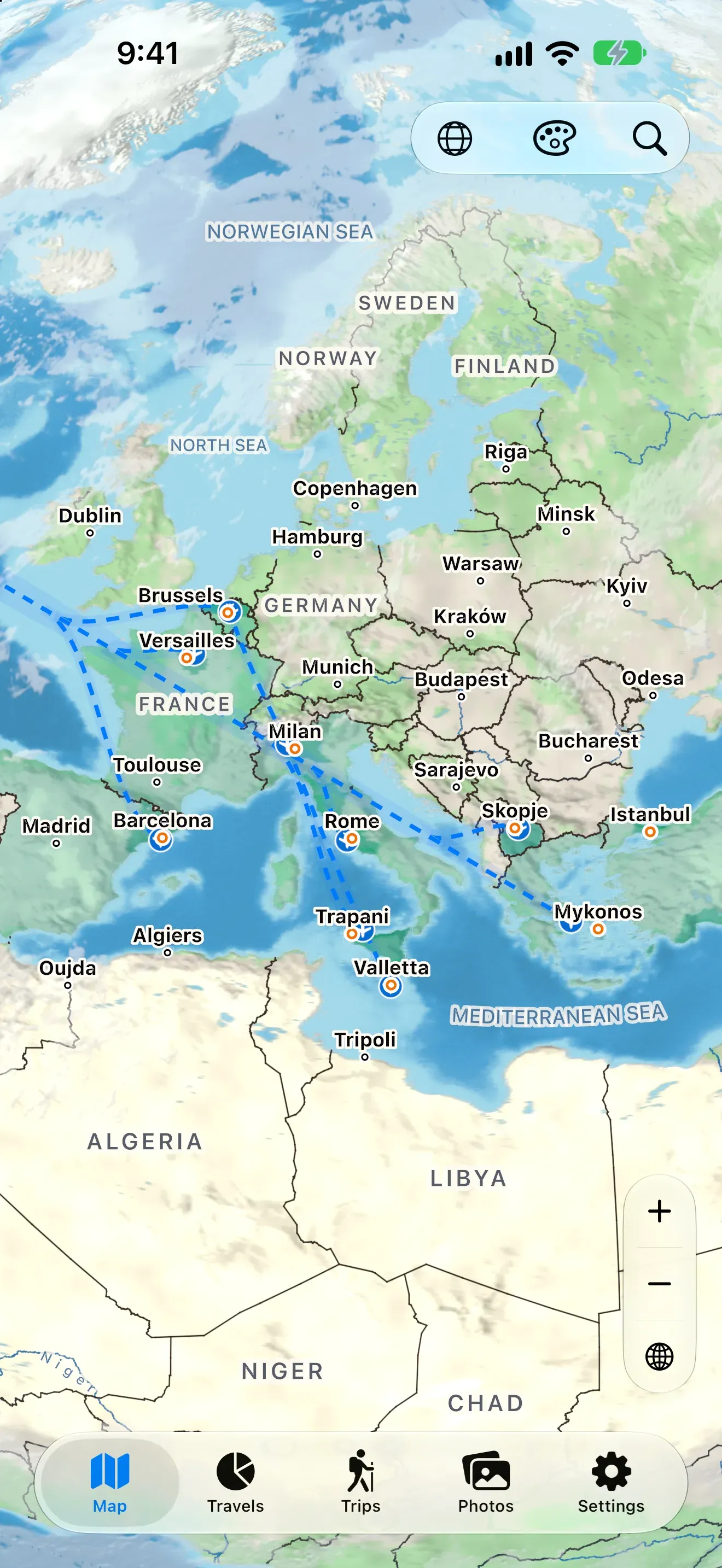
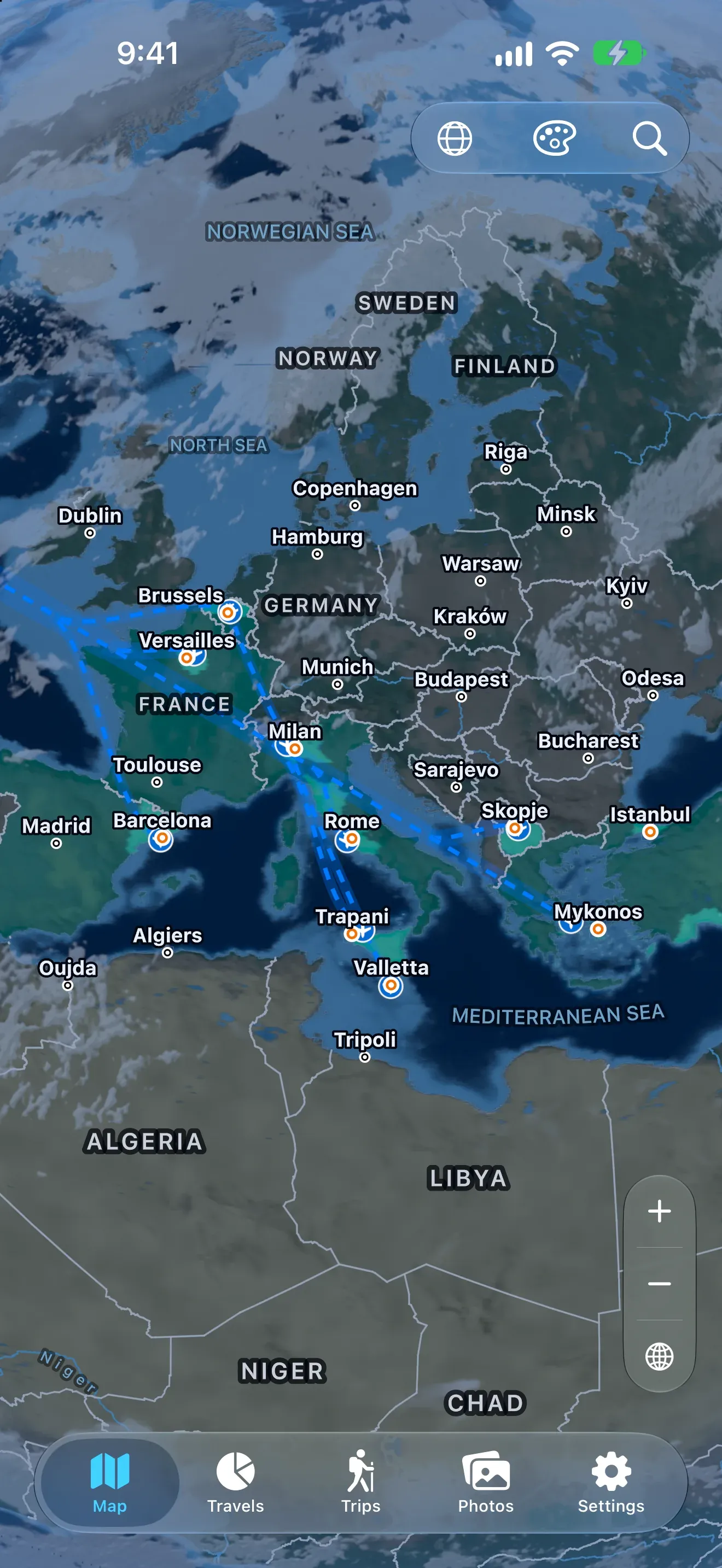
The map on iPhone: Europe and the Mediterranean, with dashed routes from Brussels and Versailles to Milan, Rome, Trapani, Valletta, Skopje and Mykonos.
  • A globe, or a flat mapOn a globe or on three flat projections.
  • From Earth to a mountain passCoastlines, borders and rivers at every zoom.
  • In your languagePlace names on the map, in English, Polish and French.

Trips

Your trips, found in your photos. It proposes; you decide.

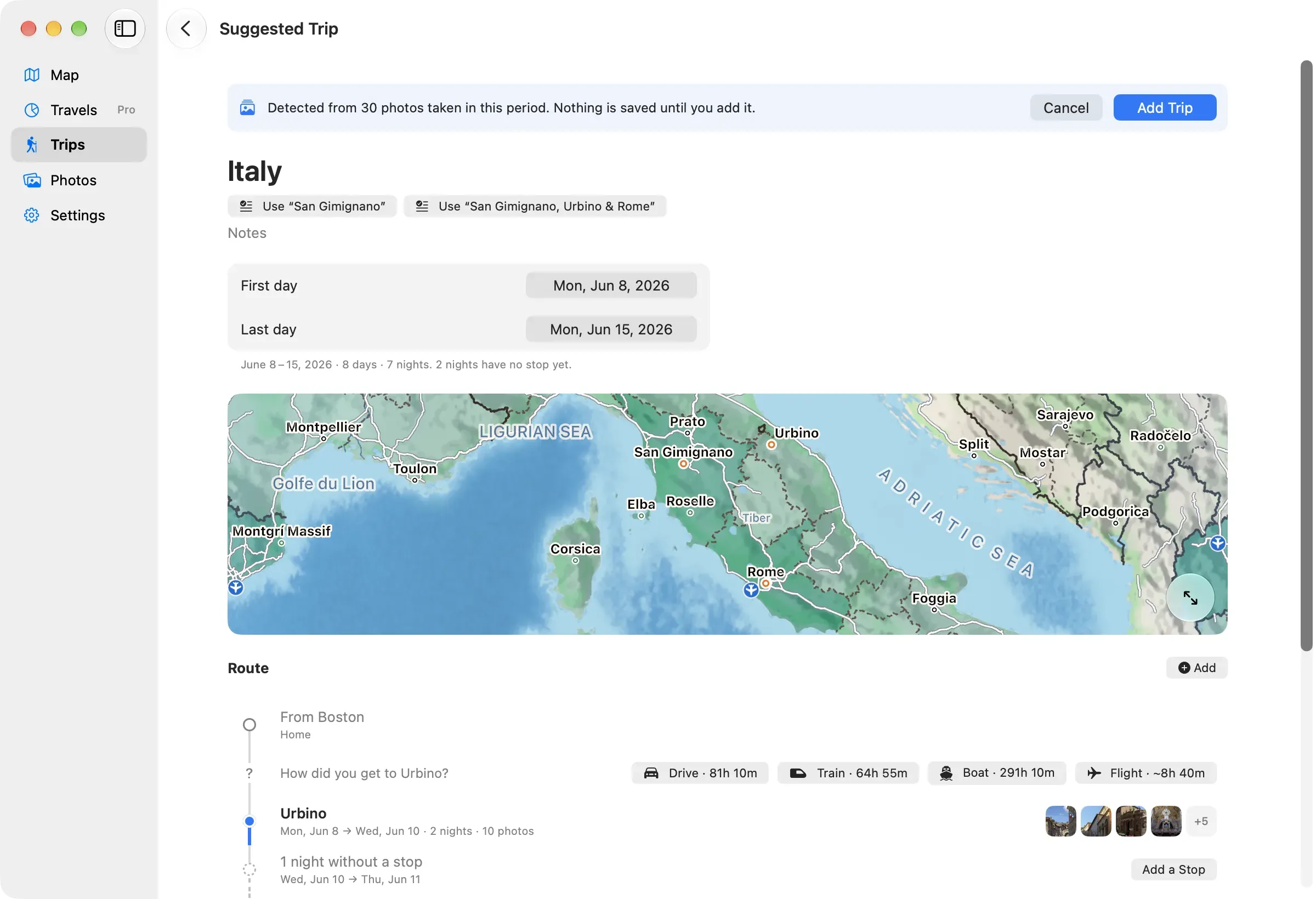
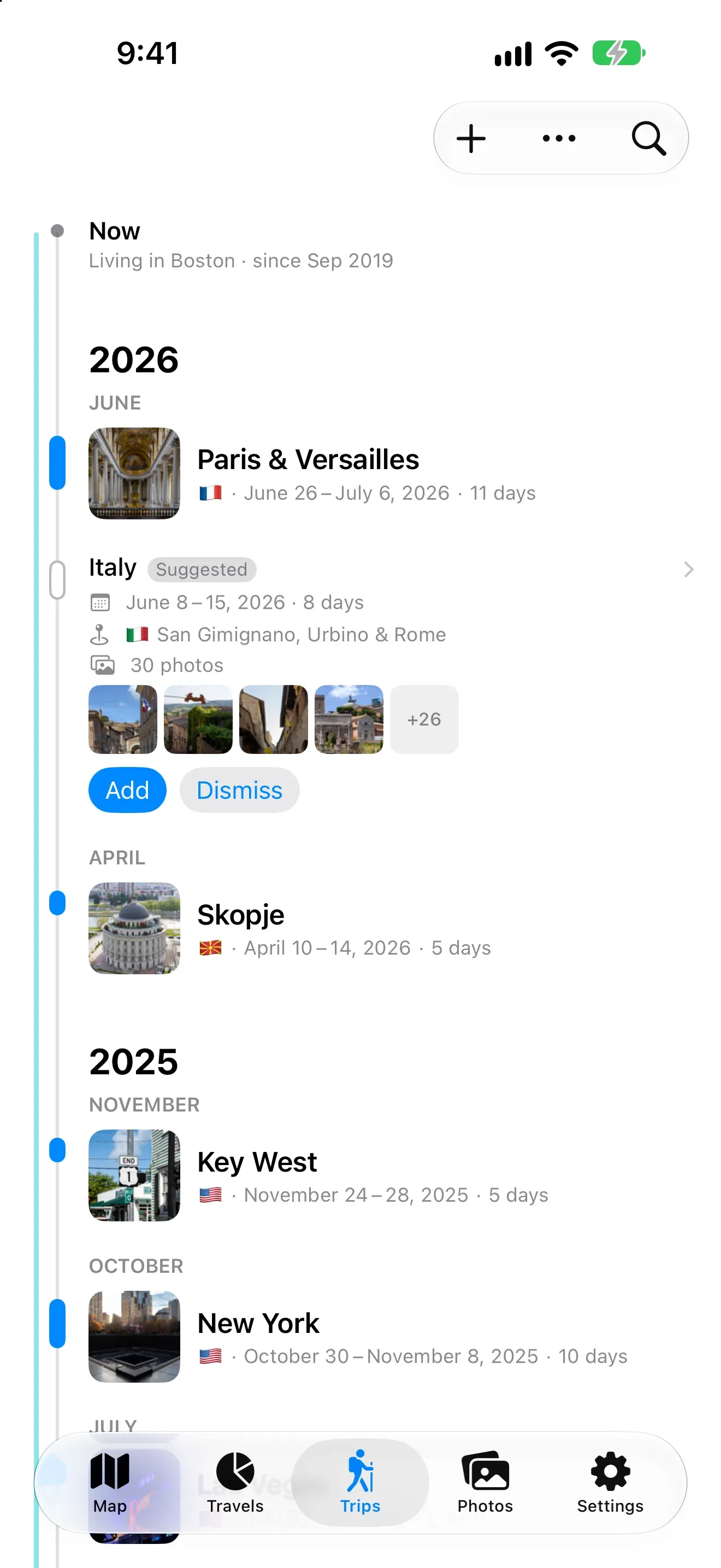
With your permission, Nookfar reads the dates and places in your photo library, finds the stays and suggests the trip. Nothing is saved until you add it.

A trip Nookfar suggested on a Mac, detected from 30 photos: Italy, June 8 to 15, 2026, eight days, a map of Urbino, San Gimignano and Rome, and the question “How did you get to Urbino?” with drive, train, boat and flight as answers.
Trips on iPhone: home in Boston, the saved trips to Paris and Versailles and to Skopje, and between them the suggested trip to Italy, eight days and 30 photos, with Add and Dismiss.

Photos

Every trip keeps its photos. Right where you took them.

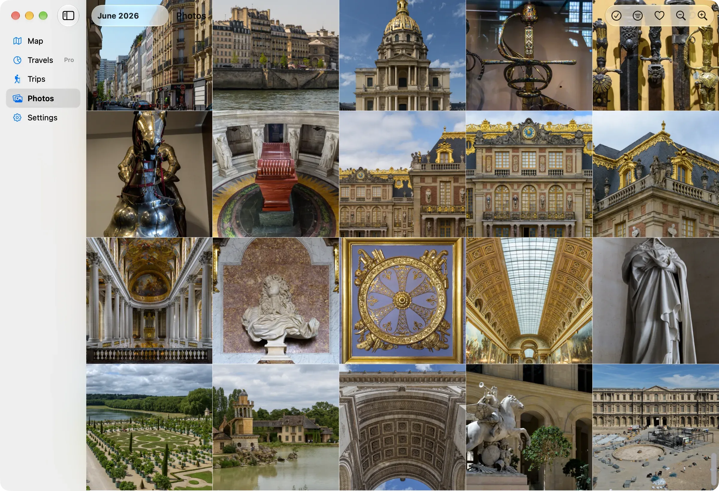
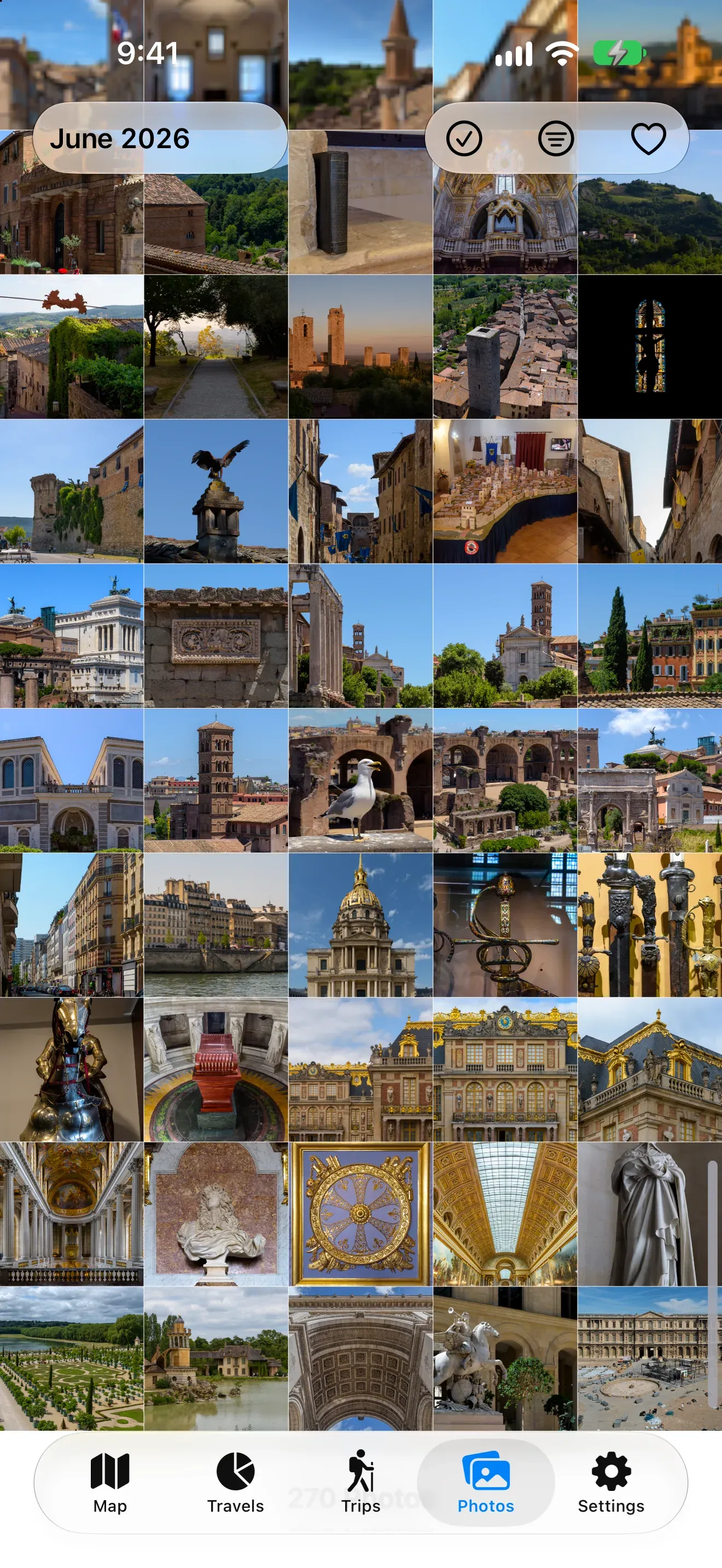
A trip's page shows the photos taken on it, and the Photos tab holds your whole library, month by month.

The Photos tab on a Mac, June 2026: twenty photos from Paris and Versailles, among them the dome of Les Invalides, armour in the army museum, the palace of Versailles, its gardens, and the Louvre.
The Photos tab on iPhone: a dense grid of June 2026, from Italian hill towns to the palaces of Paris.
  • The trip's own photosEach trip shows the photos taken on its days and at its places.
  • One that doesn't belongTake it out of the trip; it stays in your library, and it can go back.
  • Read, never copiedNookfar shows the photos from your library; it keeps no copies of its own.

The journal

A trip is a story, not a form.

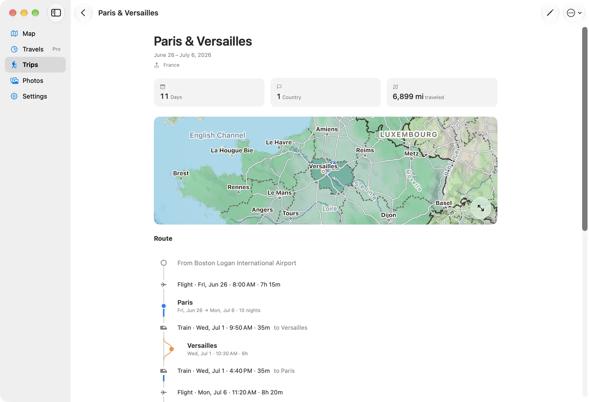
  1. From Boston
  2. Flight · Fri, Jun 26 · 8:00 AM · 7h 15m
  3. ParisFri, Jun 26 → Mon, Jul 6 · 10 nights
  4. Train · Wed, Jul 1 · 9:50 AM · 35m
  5. VersaillesWed, Jul 1 · 10:30 AM · 6h
  6. Train · Wed, Jul 1 · 4:40 PM · 35m
  7. Flight · Mon, Jul 6 · 11:20 AM · 8h 20m
  8. To Boston
The trip's own page, cropped to its map: Paris and Versailles, shaded in the Île-de-France.

A route, not a form

Stops, nights and day trips, with the way between each pair of places. Every date on the page follows from the route.
Asked, never guessed

How you got from one place to the next is yours to say. Nookfar asks.

The whole trip at a glance

Days, countries and distance, worked out from the route.

Works on a plane

The whole world map and every place you can search for are built in. There is nothing to sign in to.

Borders, in a view you choose

Contested borders can follow different published views, and the map says whose view it is showing.

The map on iPhone in daylight colors: Europe with visited countries shaded and dotted flight routes.
The same map on iPhone in dark colors, with the visited places in teal and glowing flight routes.

In daylight, or at night

The map follows your device: daylight colors, or dark ones with routes that glow.

Privacy

Your travels stay yours. No account, nothing uploaded.

Nookfar's five privacy promises. Each one is checked by a script against the code that would break it.

  1. Your travel history stays on your device.

    Nookfar never uploads your photos or travel history.

  2. Photos are read, never copied.

    Photo locations and dates are read to match photos to your trips, to show a place's or a region's photos when you open them, and, with trip suggestions on, to suggest new trips. The app never copies a photo on its own; choosing Share makes a temporary copy to hand to wherever you send it, deleted once the share is done.

  3. Nothing the app reads reaches the developer.

    The app makes no request of its own: nothing goes to any server the developer runs, or to anyone else. The whole world map, and every place you can search for, is built into the app, and a place it lacks is one you type in yourself. Apple is involved the way it is in any app: a photo kept only in iCloud is fetched when it is shown, shared or described for VoiceOver; the App Store region is checked when the map perspective or the starting place is not set yet, to pick them; and where a law requires it, Apple is asked for your age range.

  4. Health data is shown, never stored.

    Health data, if you allow it, is read for the dates of a trip each time you open it, only displayed on screen, and never stored — not on this device and not anywhere else.

  5. No analytics, no trackers, no accounts.

    There are none. The dates and places in your photos are analyzed only on your device, only to build your travel history, and never for advertising, scoring or decisions about you.

How it's made

Under the map.

A Metal engine written for it and a boundary dataset built for it, so that every line on screen is one I can account for.

How it's made

Statements

On contested borders

These perspectives describe positions published by states and international bodies. They are not the developer's own, and choosing one neither endorses it nor determines any territory's legal status. Boundaries come from Natural Earth's public-domain data and are not authoritative.

Accessibility

Every screen reads with VoiceOver, the map included: it says what is in view and names the places you have visited, and each photo is described when you reach it. Screens outside the map follow your system text size. Visited places are marked by a pattern as well as a color, the map can be reached from a keyboard, and Reduce Motion is respected. If something is still hard to use, say so; the address on this site reaches a person.

The photos in these screenshots are by Julian Lupyan, released to the public domain. Photo credits

Where you've been, drawn on your own device.

Not on the App Store yet. It ships for iPhone, iPad and Mac at the same time.